Disturbance Events
Browse some of the verified and potential forest disturbance events captured by the ForWarn tracking system.
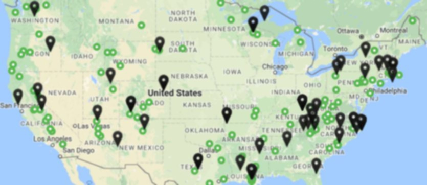
Highlights
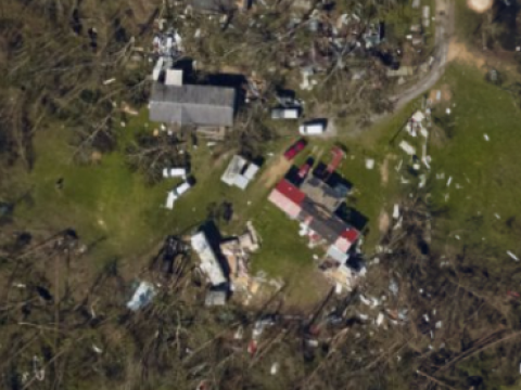
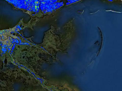
The destructive impacts of Category 4 Hurricane Michael on the forests of northwest Florida were captured by ForWarn II's routinely produced Early Detect product one week after the event.
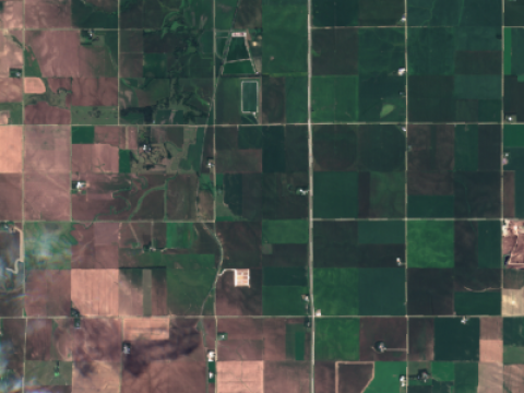
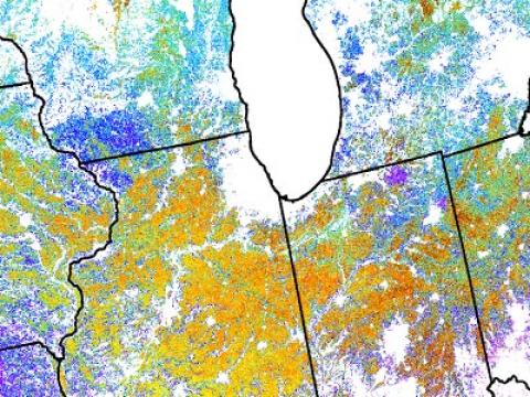
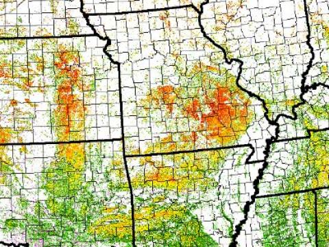
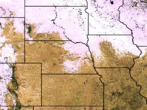
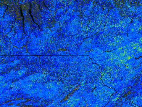
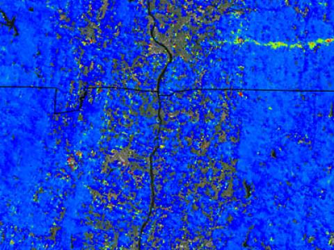
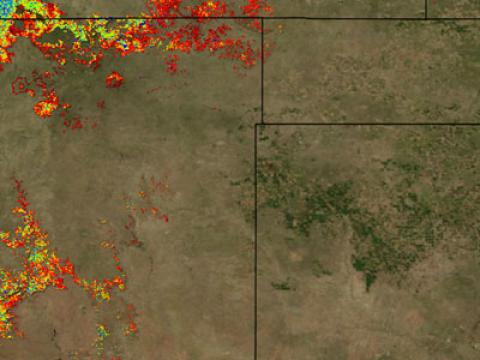
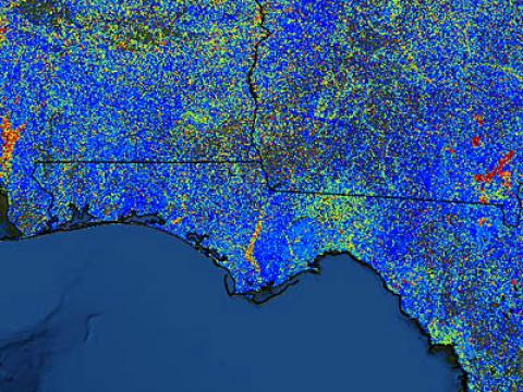
ForWarn's all-lands approach to monitoring provides valuable insights into crop damage caused by summer storms. In July and August of 2018, hail storms struck eastern Nebraska causing severe damage to corn and soy.

Hurricane impacts to forests can vary greatly depending on the qualities of the storm.
ForWarn’s ability to accurately map defoliation comes from the high temporal frequency of the source imagery (MODIS).

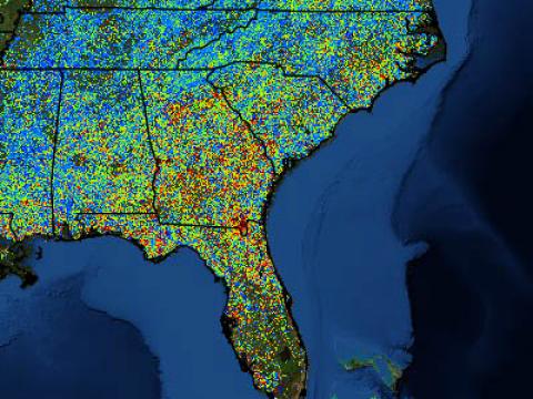
Remote sensing technologies provide an increasingly efficient way to monitor large tracts of forest canopy conditions in near-real-time and seasonally.
Remote sensing is adept at identifying and qualifying many forest disturbances, but there remains a substantial need to further quantify actual impacts in many cases.
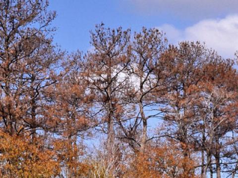
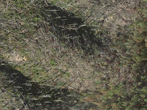
The Forest Tent Caterpillar (Malacosoma disstria) is a widespread native defoliator of deciduous forests in the Eastern US.
The Pandora Moth (Coloradia pandora) is a native defoliator of ponderosa, Jeffrey and lodgepole pine trees of the Western US. During most years, populations and defoliation is minor, but periodic outbreaks cause widespread defoliation (Speer and others 2001).

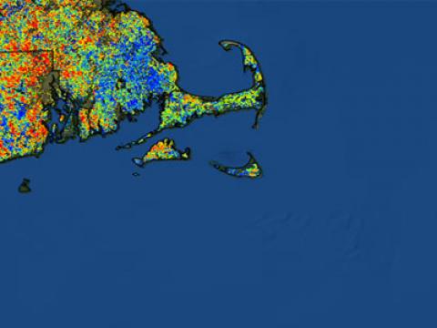
Urban areas are renowned for their admixture of species and vegetation types that can change from one parcel to the next. Yards and woodland parks intermix with road medians--all of which may be dominated by an irregular mix of native and exotic trees, shrubs, herbs and grasses.
Understanding the normal start of greenup for croplands is important because it provides a baseline to compare year to year conditions.
The start of the annual growing season is among the most important climate-sensitive measures that Land Surface Phenology (LSP) products like ForWarn can provide.
It can be challenging to detect disturbances during seasonal periods of transition such as Fall or Spring in the eastern deciduous forest.
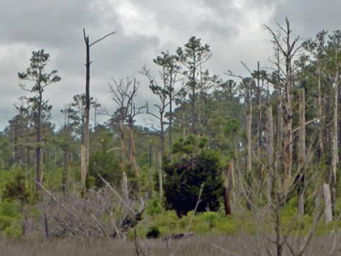
Coastal forests and shrublands can be vulnerable to climate-associated disturbances such as the strong winds and storm surges associated with hurricanes.
During the first week of June 2014, hail caused significant damage to corn and soybean fields in eastern Nebraska and western Iowa.

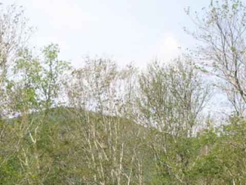
Across the Southern Appalachians, Eastern Hemlock has long created an important ecological niche. As these trees are evergreen, they provide year-long cover for wildlife and they cool riparian areas where they tend to grow.
ForWarn's true color product is produced every 8 days at 1km resolution to provide a quality control for ForWarn's disturbance maps. Clouds and snow cover that persists for the entire 24-day MODIS collection window can create the appearance of vegetation disturbance, when it is not.
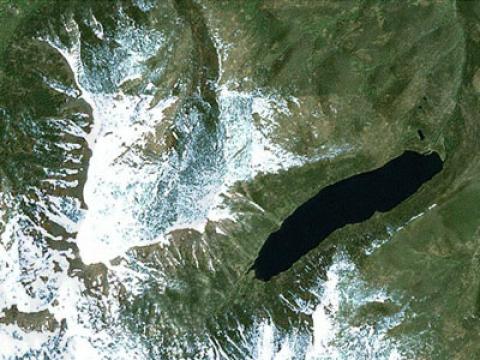
Year to year variation in climate has been extreme in California's Sierra Nevada. In particular, low winter snowpack raises concerns about municipal water supplies as reservoirs are fed by spring meltwater. However, low winter snow cover has implications for the region's forests as well.

Sudden Oak Death (SOD) is a disease caused by the new pathogen Phytophthora ramorum (Frankel and others, 2013). This spore-producing water mold was first observed when tanoak trees began dying during the mid 1990s in California’s Marin and Santa Cruz Counties.
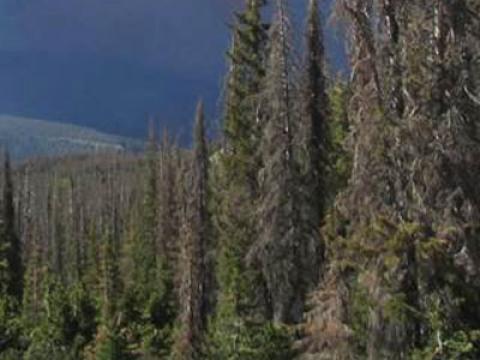
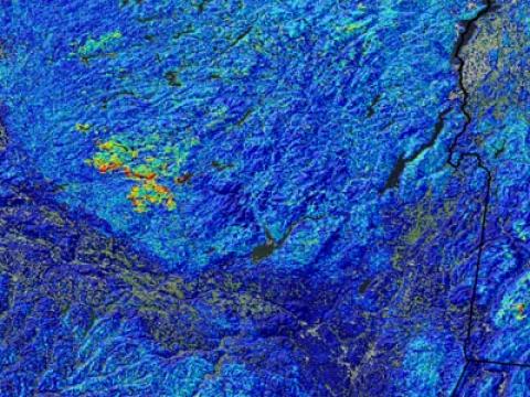
Since 2004, southwestern Colorado's Englemann spruce forests have experienced a severe outbreak of spruce beetles (Dendroctonus rufipennis). Such outbreaks occur episodically, multiple times per century (Anderson et al. 2010).
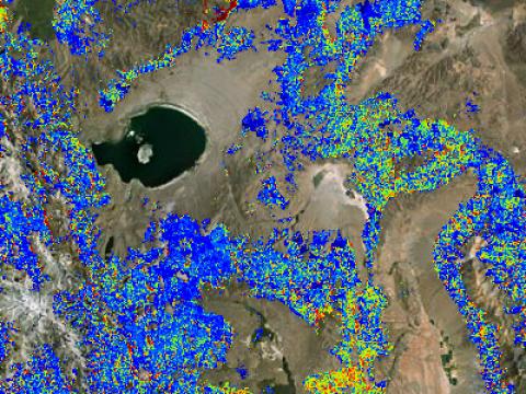
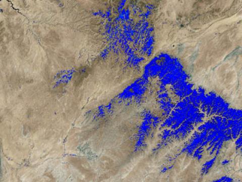
The 2013 Rim Fire burned over a quarter million acres of California's Sierra Nevada, including a portion of the Stanislaus National Forest and Yosemite National Park. It started in mid-August as an illegal campfire after an unusually dry winter and spring.

In early September of 2013, unusually heavy rain resulted in catastrophic flooding across Colorado’s Front Range and downstream along the South Platte River. Rainfall exceeded 20 inches northwest of Denver, which is close to the average rainfall for that area during an entire year.
By late 2012, forest health monitors in western New York and Pennsylvania knew that they were about to experience a severe outbreak of the non-native Gypsy Moth.
ForWarn's standard calculation of the current state of vegetation is based on the maximum NDVI value observed for each 24 day period. This standardized window is needed to minimize the chance that clouds or other atmospheric effects will cause misleading results in the change product.
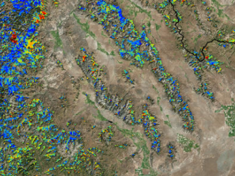
Land managers in the West seek to efficiently monitor their forests and rangelands, particularly after wildfire. ForWarn's high frequency record of the Normalized Difference Vegetation Index (NDVI) provides a coarse filter means to accomplish this using two measures.
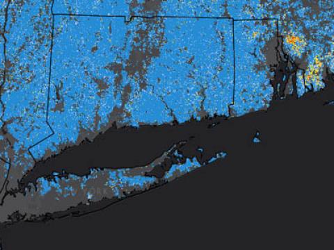
Hurricane Sandy, one of the most damaging hurricanes to strike the United States, tested the monitoring ability of the ForWarn system. Detecting any disturbance is difficult during the spring and fall because vegetation is actively changing due to normal seasonal dynamics.
ForWarn's MODIS satellite-based products go back to 2000, and this allows us to observe the effects of wildfire and recovery since early in the decade.
The spring of 2012 was exceptional across much of the eastern US because it occurred weeks earlier than normal. Yet some forests also experienced strong spring hail storms that left leaves in tatters and set spring growth back.

ForWarn's ability to capture short and long-term change is shown by this animated image pair that provides two different temporal contexts for the same date in May of 2012. The "all year" baseline shows change since 2000.
Over the last 15 years, Mountain Pine Beetles have killed large tracks of ponderosa pine across the Black Hills of South Dakota. Beetles thrive with continuous stands of dense trees, and decades of fire exclusion have led to that landscape and stand-level condition.
Across Texas, 2011 will long be remembered as the year that the trees died.
Spring often brings defoliating insects to the forests of Louisiana. In this image from early May 2010, defoliations from forest tent caterpillars and baldcypress leafrollers create an erupting "measles-like" pattern.
This late April 2010 image shows a large anomaly just east of Lake Ontario on the Tug Hill Plateau of New York. A less severe area of departure from the prior year’s condition occurs to the east.
Outbreaks of the defoliating pine butterfly are rare. In eastern Oregon, outbreaks occurred in 1908-11, 1940-43, 1982 and from 2008 to 2011. Sometimes defoliations can lead to mass mortality of ponderosa pine—the primary host, but not always.
The Atchafalaya basin's forests thrive with seasonal flooding, yet high water is normally a spring phenomenon there. During the past month, unusually high water levels have inundated wetlands and forests along and near the Mississippi River basin.
The forests of Texas continue to suffer through one of the most extreme droughts on record and a large number of trees have already died. The photo shows mortality in Memorial Park, Houston (Ron Billings, Texas Forest Service).
This fall 2011 webworm outbreak in the Hickory Creek Wilderness Area of the Allegheny National Forest, Pennsylvania stands out against the near normal (blue) background that dominated the state in early fall.
In September of 2011, the Pagami Creek Fire burned over 92,000 acres in the Boundary Waters Canoe Area Wilderness (BWCAW) of the Superior National Forest, Minnesota Much of this burned at high severity, as indicated on the October forest change image.
A sizable portion of the Wenatchee National Forest, Washington shows less vegetational vigor than it did at its peak of the last decade.
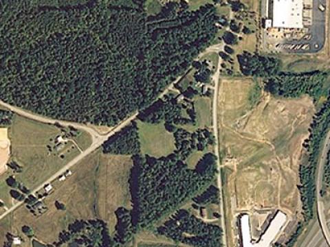
Substantial forest area has fallen to development in the periphery of many urban areas over the last decade. The image below shows deforestation in the periphery of Raleigh, NC as yellow to red anomalies. Blue areas have not changed during the last decade.
On April 24, 2010, a lethal F4 tornado struck the forests east of Yazoo City, Mississippi. Within a few weeks the path of the storm and patterns of severity are clearly shown with this comparison of conditions relative to the same time in 2010--the year before the event (top image).
This image shows forest change anomalies on the north slope of the Wasatch Range of Utah on September 13, 2011 compared to the prior year. The high elevation zone above treeline is shown as an uncolored area under the words “Wasatch Range”.
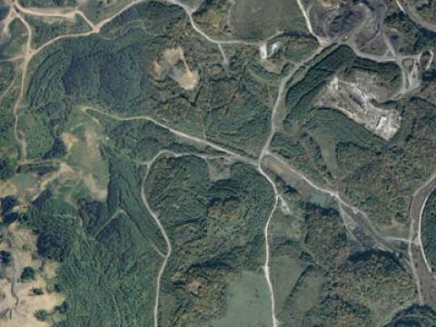
Deforestation for strip mining is common practice in the coal regions of eastern Kentucky, Virginia and West Virginia. The image below shows areas where forests have been removed for mining over the last decade (left).

This before-after image pair shows changes associated with Hurricane Irene. Its path is shown by the bold blue line. In the pre-Irene image (left) shades of green and yellow show the effects of drought on vegetation and dark red spots are recent wildfires.
In June, the Wallow Fire burned over half a million acres in east-central Arizona, much of it on the Apache-Sitgreaves National Forests. A substantial portion of the burn area was of high severity, killing millions of trees outright.

Georgia’s Okefenokee Swamp National Wildlife Refuge near the Georgia-Florida line burned in 2007 and again in 2011. This rapid recovery of fuels reflects the importance of sprouting vegetation. In the map sequence from the summer of 2011, this resilience is clear.
The Pains Bay Fire was started by lightning on May 4, 2011 in the peaty soils of North Carolina’s coastal plain. By the end of June, the fire was contained, but the deep soils continued to smolder for weeks. The white line marks this 45,000 acre fire’s final perimeter.
A severe tornado touched down near Springfield, Massachusetts on June 1, 2011, then carved a path through nearly 30 miles of state and private forest. The streak in red show an extreme reduction in growth compared to the prior year’s condition as of mid-June.
According to climate data, coastal North and South Carolina were having a mild drought in mid May of 2011.
The April 27, 2011 tornado that hit Great Smoky Mountains National Park in eastern Tennessee was a powerful EF4 storm (its direction is indicated by the black arrow).
Full-fledged tornadoes are typically well documented, but the massive outbreak of April 2011 also had localized short-term effects that are easily overlooked.

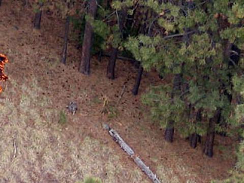
Forests across northern Mississippi, Alabama and Georgia were hard hit by tornadoes in April, 2011. Tree mortality was often severe for areas in the direct path of these storms as shown in this photo from near Lake Burton in the Chattahoochee National Forest, Georgia (top).
Other Disturbances Assessed

Moderate to severe NDVI decline for parts of Pierce, Wayne, Stanton Counties of NE - mostly areas north of Norfolk, NE
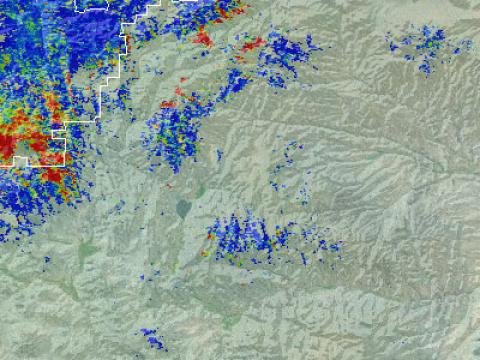
Hail streak showing up in the upper mid-western US in 3 counties of SD (Edmunds, Brown, and Days counties going west to east). According to on-line news accounts, the storm occurred on 8-28-21.

Forest canopy greenness decline in portions of Montmorency, Alpena, Alcona, and Oscoda counties of Michigan
A spate of severe weather occurring on October 20-21, 2019 caused a number of tornadoes to effect Dallas-Fort Worth, TX.
2007 WI Tornado still recovering (over 10 years after the event)
From potential tornado dated 05/06/2019, see linked news and storm reports.
"Area was hit hard by gypsy moth caterpillar defoliation for the third year in a row. We mapped it during this years aerial survey and ground truthed the area last week to confirm gypsy moth as the primary defoliation agent".
There was no response received to initial email inquiry.
Areas east of Sault Ste. Marie, Ontario, Canada. Agent appears to be active eastward to New Brunswick to n. Maine.
"The disturbance in this area has been reported at hail damage".
Forest defoliation by baldcypress leafroller and forest tent caterpillar detected in these southern Louisiana counties: Ascension, St. James, Assumption, n. Lafourche, n. Terrebonne, St. Martin and e. Iberia County.

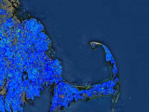
ForWarn has detected bottomland areas of North Carolina, South Carolina, Georgia and Florida that were affected by Hurricane Matthew in October, 2016. The data shows the intensity of the wetland flooding.


ForWarn has detected a potential double disturbance in portions of Stanislaus National Forest and Yosemite National Park, California in 2015 and 2016. This disturbance may be due to the rim-fire followed by burn land management efforts.


ForWarn potentially indicates that an area in the Fremont National Forest, Oregon experienced a decline in green vegetation due to the Mountain Pine Beetle from 2004 through 2010 and still may not have recovered in terms of vegetation canopy green
ForWarn indicated that the Chippewa National Forest and surrounding areas had a decline in vegetation greenness due to a storm event on July 22.
ForWarn has detected potential widespread storm damage for the Superior and Chippewa region of Minnesota and surrounding areas from July, 2016. High winds led to downed trees that appeared in the data showing landscape change.
ForWarn identified a decline in vegetation greenness in the Black Hills National Forest. The August 2016 disturbance is attributed to tree cultivation in the area.
ForWarn has detected a slight decline in green vegetation within the Isle Royale National Park in Michigan in August 2016. The disturbance is likely caused by a severe storm or potential insect damage.
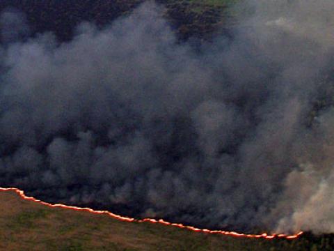
ForWarn has detected fire damage for Kern county, California from June 24 to June 30, 2016. The widespread burning caused decline in vegetation greenness in the area.
ForWarn has potentially identified an anomaly in vegetation greenness in the Santa Fe National Forest near Santa Fe, New Mexico, including portions of Sangre de Cristo Mountains in 2016.
ForWarn has detected a disturbance in vegetation greenness in Mackinaw State Forest, Michigan. The decline is likely due to a hail event on July 8, 2016 that created damage to foliage.

ForWarn detected a linear disturbance in Luzeme County, Pennsylvania in 2015. Forest fragmentation is likely attributed to natural gas line development.
ForWarn has identified an anomaly in the lowlands of Hiawatha National Forest in Mackinac County, Michigan in July 2016.
ForWarn detected a weather related forest disturbance in Lake of the Woods County, Minnesota. Wind damage from a severe storm caused a moderate decline in vegetation greenness.
ForWarn detected a decline in vegetation greenness within the Cherokee National Forest, Watauga Ranger District in TN by severe weather on July 8, 2016.
ForWarn has identified a disturbance on July 2, 2016 in central Oregon. Decline is likely due to Pandora Moth defoliation of pines in the area.
ForWarn has detected anomalies in the Connetquot River State Park Preserve and the surrounding area in Long Island, NY from June 8 to July 12, 2016.
ForWarn detected a decline in vegetation greenness in Jefferson National Forest, Virginia. Gypsy Moth outbreak in the area is the confirmed cause.
ForWarn has detected a defoliation event in Carbon county, Pennsylvania in May to June 2016. Insect infestation is the likely cause of the event.
ForWarn detected a defoliation event in eastern Conneticut, western Rhode Island, and eastern Massachusetts in June-July 2016. Gypsy moth catepillar defoliation is the likely cause of the event.
ForWarn has detected hail damage in Kentucky on June 17, 2016. The severe weather event on May 10, 2016 created decline in vegetation greenness by damaging foliage.
ForWarn has detected hail damage in Kentucky on June 17, 2016. The severe weather event on May 10, 2016 created decline in vegetation greenness by damaging foliage.
ForWarn has detected anomalies in June, 2016 at Mt. Baldy, California and Apache National Forest, Arizona. The cause is unknown but is potentially due to spruce aphid defoliation or drought suppressed greenup.
ForWarn identified a decline in vegetation greenness in Sussex and Warren Counties of New Jersey. Detected in June 2016, the cause for the decline is unknown.
ForWarn has detected an anomaly in Jefferson National Forest, Virginia on May 23, 2016. It is suspected that a moving hail event caused the defoliation.
ForWarn detected a decline in vegetation greenness in May, 2016. Residual damage from hail moving through West Virginia is evident.
ForWarn detected an anomaly in June, 2016, in the Asheville, North Carolina watershed. A hail event in May 2016 has been confirmed the decline in vegetation greenness from hail damage.
ForWarn has detected a disturbance in Southeast Louisiana. May, 2016, defoliation was identified by an unknown insect in the previous spring.
ForWarn indicated a disturbance in Plymouth, Barnstable, and Dukes Counties of Massachusetts. May through June 2016, an insect infestation of gall wasps and gypsy moths caused defoliation in the Eastern Massachusetts area.
ForWarn has detected an anomaly in the bottomlands of Roanoke River, North Carolina. Detected in May 2016, tent caterpillars seem to be defoliating the hardwoods in the forest as well as potential flood damage to the swamps.
ForWarn detected a possible disturbance in Webster, Nicholas, Clay, and Kanawha counties of West Virginia.
ForWarn detected possible damage by severe weather in Johnston County, Oklahoma. Identified in April 2016, the weather event occurred in March 2016. The potential hail and wind from the storm likely created decline in vegetation greenness.
ForWarn has detected a potentially ephemeral disturbance after a severe storm in March-April, 2016 in Lincoln, Lawrence and Jefferson Davis counties of Mississippi.
ForWarn has detected a severe weather disturbance event on January 8, 2016. A long-track tornado intersecting with Holly Springs National Forest, Mississippi has confirmed decline in vegetation greenness in the area.

ForWarn has detected anomalies on the agricultural lands Mississippi embayment of Arizona, Tennessee, Missouri, Mississippi, Louisiana, and the surrounding areas compared to historical data.
ForWarn has detected anomalies in Columbia, South Carolina in wetlands and forested lands. Heavy rains caused flooding in the area however, this is likely not a sign of damage.
ForWarn identified possible anomalies in the Southern Appalachians on November 3, 2015.
ForWarn has detected an unknown anomaly in the Roanoke River Wildlife Refuge, North Carolina. Identified in September, 2015, the decline in vegetation greenness appears to be due to defoliation or tree species light requirements.
ForWarn, in September, 2015, detected a decline in vegetation greenness in Northern Utah. The cause of the decline is currently unknown, possibly identified as drought and tree mortality.
ForWarn discovered decrease in vegetation greenness in northwest Colorado successively in September 2015. The cause of the decrease is unknown.
ForWarn has potentially detected a multiple factored defoliation event in wetlands of southeast Louisiana.
ForWarn detected a decrease in vegetation greenness in Pisgah National Forest, North Carolina. The event in September, 2015 was caused by a fire burning in the area, damaging foliage.
ForWarn identified a disturbance in September 2015. Based on similar patterns in data in other locations, the decline in vegetation greenness in the Chequamegon National Forest, Wisconsin, is likely due to a storm event.
ForWarn detected a decline in vegetation greenness in September 2015 in Wisconsin. There are several possible causes for the departure.
ForWarn has detected apparent decline in vegetation greenness in August 2015. The data shows characteristics of western spruce budworm population outbreak, which lasts about 10-15 years.
ForWarn identified potential disturbances in the Flathead and Lolo National Forests as well as some in the Lewis and Clark National Forest of Montana.
ForWarn found a decline in greenness in the George Washington National Forest of Virginia and Monongahela National Forest of West Virginia in August 2015.
ForWarn found a decline in greenness in the Monongahela National Forest of West Virginia in August, 2015. Gypsy moth is a historical defoliator of these areas, their damage covering one million acres in 2015.
ForWarn potentially identified a possible insect outbreak in Rio Grande National Forest, Colorado in August 2015. The unknown insect species has caused a decline in vegetation greenness in the area.
ForWarn recognized a decline in vegetation greenness east of Pikes Peak and west of Colorado Springs, Colorado on July 31, 2015.
ForWarn detected an anomaly in San Saba County, Texas in July 2015. The woodlands in the area contain grass making it more sensitive to drought than dense conifer forests.
ForWarn has identified a defoliation event in northeastern Pennsylvania in July 2015. Based on historical data from 2008 and 2014, the behavior mapped out for this event is similar to Gypsy moth defoliation.
ForWarn discovered an unknown decline in vegetation greenness. Identified in July, 2015, northeast Georgia experienced a decrease anomaly of unknown sources. Clouds potentially obstructed the analysis abilities of the detector.
ForWarn detected multiple possible defoliation events in the Humboldt National Forest, Nevada in July 2015. The pine dominated forest could be affected by insect defoliation and/or severe drought die back.
ForWarn detected multiple possible defoliation events south of White Pine County, Nevada in July 2015. The pine dominated forest could be affected by insect defoliation and/or severe drought die back.
ForWarn detected multiple possible defoliation events in White Pine County, Nevada in July 2015. The pine dominated forest could be affected by insect defoliation and/or severe drought die back.
ForWarn identified small disturbances in the San Juan National Forest, Colorado. The anomalies were disturbed west of the Weminuche Wilderness near Graham and Granite peaks and Slide Mountain.
ForWarn detected an anomaly in the San Isabel National Forest, CO. Affecting mostly lodgepole pine forests as well as some spruce-fir forest, the reason for the decline is currently unknown.
ForWarn identified an anomaly in eastern Colorado and New Mexico border. There was a decline in ponderosa pine greenness compared to the one year change data. Causes for the anomaly are currently unknown.
ForWarn detected a small disturbance south of Carson National Forest, New Mexico. The anomaly was short-lived in July 2015 and the cause of the anomaly is currently unknown.
ForWarn detected a disturbance in the Rio Grande National Forest of southern Colorado in July 2015.
ForWarn detected a decline in vegetation greenness on July 7, 2015 in southern California.
ForWarn identified vegetation greenness departure along the Red River in Texas, Oklahoma, Arkansas, and Louisiana. In July 2015, flooding of the river in these areas caused die back from waterlogging plants.
ForWarn discovered an anomaly near Willamette National Forest, Oregon, in July 2015. Clear-cutting has historically occurred, starting around December, although there are reservations about logging in the wet season.
ForWarn discovered two anomalies in the Fremont National Forest, Oregon. The two anomalies are seemingly related, one being larger in extent. The anomaly appears to be slightly brown with highly green forest adjacent.
ForWarn detected a string of departure anomalies in La Pine, Oregon. The four anomalies are arranged linearly from southwest to northeast.
ForWarn identified a large decline in vegetation greenness within the Willamette National Forest, Oregon. The anomaly has been persistent for at least three dates of product.
ForWarn detected a disturbance in the Siskiyou National Forest, Oregon. The area is regenerating from the Biscuit fire in 2002 and was reburned.
ForWarn identified an anomaly in the Lassen National Forest, California. The patches of disturbance have sharp boundaries.
ForWarn determined an anomaly north of Lake Tahoe in Tahoe National Forest, California. Hard boundaries of disturbance suggests silviculture treatment in the mixed conifer forest.
ForWarn detected an anomaly in the riparian woodland of Santa Ana River in Corona, California. The cause for the decline in vegetation greenness in the riparian area is currently unknown.
ForWarn discovered an anomaly in the Sequoia National Forest and Sierra National Forest, California. Drought had intensified compared to the previous year in the mixed oak/pine woodland. Tree mortality is largely due to drought stress.
ForWarn observed an anomaly in the Plumas National Forest, California. The mixed conifer forest/woodland has had a prior fire west of the area which could account for vegetation departure.
ForWarn detected departure of vegetation greenness in San Juan National Forest, Colorado including parts of the Weminuche Wilderness. Higher elevations below the treeline are noticing departure because of intensifying snow toward open canopies.
ForWarn identified a decline in vegetation greenness in the Rio Grande National Forest and southern San Juan Wilderness.
ForWarn identified scattered anomalies in the Coconino National Forest, Arizona. There were anomalies east of Oak Creek Canyon, near Priest Draw, Kelly Canyon, and Ritter Spring.
ForWarn discovered a decline anomaly in the Kaibab National Forest, Arizona. A fire in 2014 on Sitgreaves Mountain harshly affected the Ponderosa pine that have not yet regenerated.
ForWarn detected decline anomaly in the Kaibab National Forest, Arizona. There were two anomalies which occurred near Cocconino Rim and another in the upper reaches of Red Horse Wash.
ForWarn identified an anomaly in the San Juan National Forest, Arizona near Lost Canyon Creek. Cause for aspen decline in the forest is unknown, could be attributed to delayed greenup.
ForWarn discovered an increasing decline in vegetation greenness in Colorado a year after the Grand Mesa landslide in 2014. The slide included parts of Grand Mesa, Uncompahgre, and Gunnison National Forests according to the USDA Forest Service.
ForWarn detected a drought anomaly in grass dominant areas of California. Grass is an ephemeral indicator of drought, browning and regreening in a noticeable pattern consistent with expectations of reduced spring productivity.
ForWarn identified a decline anomaly in the Morris and Passaic Counties of New Jersey. Gypsy moth is historically active in the area during the time of reporting, June 2015.
ForWarn identified an anomaly in the Kaibab National Forest of Arizona near the Jacob's Lake area. Defoliation is actively growing and shifting between hosts, timing, and species.
ForWarn detected departure in the wetlands of the Savanna State Forest in Central Minnesota. The phenological period of the area is still at an anomalously wet spring which may be tied to the departure of vegetation greenness.
ForWarn observed peculiar anomalies within the privately owned shrubland/grasslands of eastern Montana. The anomaly began in late April had has been intensifying.
ForWarn noticed a decline in vegetation greenness in the shrublands and grasslands north and south of the Columbia River, Oregon. There is evidence of strong departure compared to the long-term average and intensifies with elevation.
ForWarn detected a decline in vegetation greenness in California. Grass and shrublands during this year have displayed drought behavior more considerably compared to the long-term seasonal average.
ForWarn discovered vegetation departure east of Albany, New York; northwest Massachusetts, and southwest Vermont. The relatively small phenomenon seems to be more intense when compared to historical insect data.
ForWarn indicated a decline in vegetation in the woody wetlands of St. Louis and Atkins Counties, Minnesota. Based on data from 2014, the anomaly could be indicative of budworm and larch case bearer insect activity.
ForWarn detected a disturbance in the croplands of east Texas. Excess precipitation in the previous months on bare soil croplands caused waterlogging and flooding.
ForWarn discovered a decline anomaly in the Manistee National Forest, Michigan. The behavior of the anomaly is consistent with previous years.
ForWarn detected a steep decline in vegetation greenness in California, Nevada, and South Dakota herbaceous and scrub/shrublands. The large decline is likely due to drought in these drought-sensitive areas.
ForWarn discovered a regional anomaly within the western United States. The herbaceous range vegetation in the region has prominent decline in greenness affected by multi-year drought.
ForWarn detected prominent decline in greenness encompassing large anomalies for multiple western US states. Drought across these states accounts for the decline in herbaceous range vegetation.
ForWarn detected prominent decline in greenness in the herbaceous range vegetation of South Dakota. Drought accounts for the decline.
Forwarn indicated a decline anomaly in the upper peninsula of Michigan. The disturbance affected mostly Aspen and dissipated after a week. The cause for decline is unknown but may be attributed to a late green-up .
ForWarn observed a decline in the swamp forest of Louisiana. The decline has occurred annually due to insect defoliation.
ForWarn discovered defoliation in the Pennsylvania ridges and New Jersey highlands. The area of the anomaly is consistent with anomalies of years prior.
ForWarn identified an increasing anomaly along the coastal border of Rhode Island and Maine. The intensification is consistent with previous year's data to be apparent winter moth defoliation.
ForWarn detected a potential multiple threat anomaly in southeastern Missouri. Particularly on private lands, there are clusters that exhibit areas of stronger departure.
ForWarn detected weather damage in Northern Louisiana. A storm in late April moved through the forest and croplands causing damage to vegetation greenness.
ForWarn identified a disturbance in the bottomlands of coastal South and North Carolina. The swamps of the Carolinas have seen progressive defoliation by an unknown insect.
ForWarn discovered an anomaly in the Ozark-St. Francis National Forest, Arkansas. A severe weather event harshly hit Mt. Magazine and the south slopes. High elevation trees were partially leafed out which were damaged by the hail streak.
ForWarn displayed a disturbance in the Trinity River swamps in southeast Texas. The moderate decline in vegetation greenness is potentially due to insect defoliation within the swamps.
ForWarn displayed a disturbance in the Atchafalaya and Lake Maurepas swamps of southeastern Louisiana. The prominent defoliation is likely due to an insect of unknown species.
ForWarn discovered a disturbance in East Central Texas within the coastal plains post oak savannah. Detected mostly in hardwood areas, the decline may be attributed to the 2001 drought.
ForWarn identified a defoliation disturbance in Louisiana's Atchafalaya River Basin coastal swamp forest. The defoliation in the area of concern is often an annual occurrence.
ForWarn discovered a reoccurring anomaly in the bottomland wetlands of South Carolina. Similar anomalies were seen in 2010, 2014, and 2015 in the area of concern.
ForWarn identified a former disturbance regarding the Oso, Washington mudslide in March 2014. The view of this event in the summer shows the background forest with minimal ephemeral change during this time of year.
ForWarn identified a forest disturbance in Okanogan County, Washington. The forest had been previously harvested with regeneration.
ForWarn detected an apparent decline in vegetation greenness near Jackson Lake, Wyoming. The moderate and persisting decline does not exhibit the behavior of a fire.
ForWarn observed a substantial departure anomaly in portions of the Chequamegon-Nicolet National Forest and a portion of the Saint Croiz National Scenic Riverway, Wisconsin.
ForWarn identified anomalies along the Olympic Peninsula of Washington. The event is attributed to insect defoliation.
ForWarn detected a progressing decline along the Wind River Range in Wyoming. The mountain range, part of the Rocky Mountains, has been declining incrementally over the three most current dates.
ForWarn observed a drop in vegetation greenness in the Teton Wilderness, Wyoming. Although there was a burn in 2012, this event is probably insect defoliation.
ForWarn detected a departure in vegetation greenness in northern California. Drought is the cause for the decline.
ForWarn identified an anomaly in north-central Washington. Wildfires spread throughout the area of concern is the cause of the decline in vegetation greenness.
ForWarn detected a multiple threat anomaly in the Adirondacks, New York. The progressive decline in the mountain range could be due to insect defoliation or the summer phenology of the plants.
ForWarn identified a persistent reduction along the ridges of central and east Pennsylvania. The areas of concern have a history of insect defoliation during the spring and summer.
ForWarn detected a disturbance in the New Jersey Pine Barrens. The heavily forested area extends through seven New Jersey counties. Insects are suspected to be defoliating the area accounting for the departure of vegetation greenness.
ForWarn identified a disturbance near Roanoke River, North Carolina. The persistent disturbance may be attributed to an ice storm causing damage to foliage. The confirmed cause for the departure is currently unknown.
ForWarn observed greenness departure in northern California as well as southern Oregon. Wildfires burning through the area are the cause for the decline.
ForWarn detected a decline in southeast Asheville, North Carolina. Severe weather is the possible cause for the vegetation departure.
ForWarn detected a decline in the Eastern Highland Rim of Tennessee. Severe weather is the possible cause for the vegetation departure.
ForWarn observed a decline in vegetation greenness in northwest South Carolina. The cause for the anomaly is currently unknown.
ForWarn observed a decline in vegetation greenness in easter West Virginia. The cause for the anomaly is currently unknown.
ForWarn identified an anomaly in north central Vermont in June 2012. The cause for the decline in vegetation greenness is currently unknown.
ForWarn discovered an anomaly in Berks and Chester counties of Pennsylvania. Insects are suspected of defoliation, promoting greenness departure.
ForWarn identified an anomaly in Franklin and Bedford Counties of Virginia. The linear decline in vegetation greenness is attributed to a hail storm event which damaged foliage, declining vegetation greenness.
ForWarn observed an anomaly in the Black Hills National Forest located within South Dakota and Wyoming.
ForWarn detected a decline in Forbes State Forest, Pennsylvania. Silviculture treatments in the area account for the loss of vegetation greenness.
ForWarn identified a disturbance anomaly in west-central Alabama. The cause for the decline in vegetation greenness is silviculture treatment in the area.
ForWarn identified departure in Aroostook County, Maine. There is suspected harvest activities in the area. Silviculture treatment is the main cause for the decline.
ForWarn detected departure of vegetation greenness in the Huron National Forest, Michigan. The cause for the decline is currently unknown.
ForWarn detected an anomaly in the Allegheny National Forest, Pennsylvania in August 2012. Insect defoliation is the probable cause for the decline in vegetation greenness.
ForWarn detected a disturbance in Potter County, Pennsylvania in July 2012. The cause for the decline in vegetation greenness is currently unknown but may be attributed to insect defoliation.
ForWarn detected a disturbance on Hurricane Mountain, North Carolina. The cause of the disturbance is currently unknown.