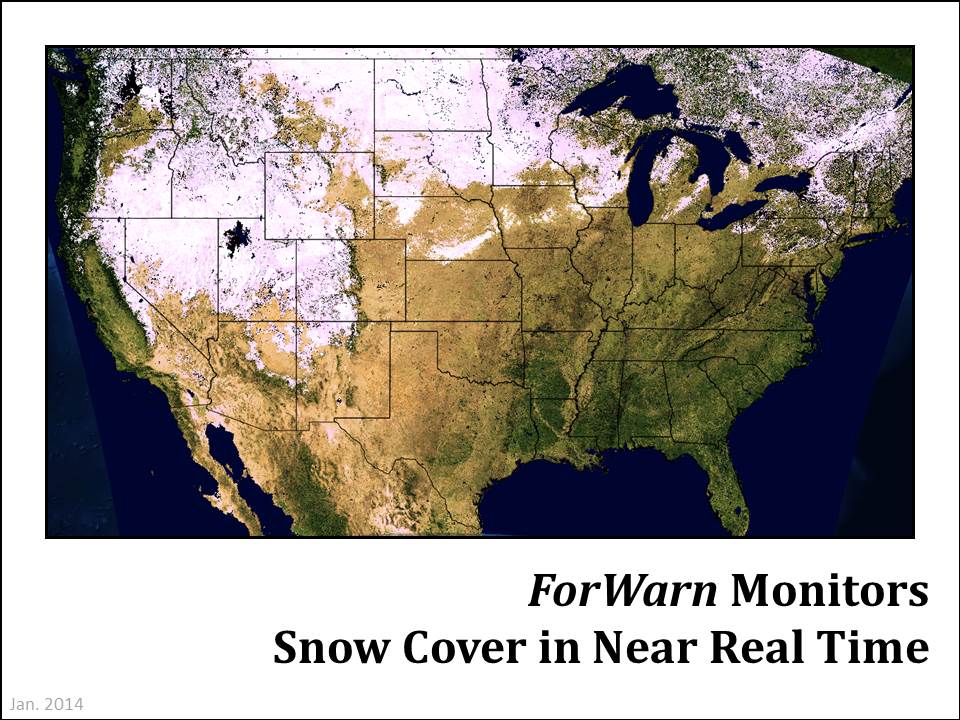
Monitoring snow cover in near real time

More information about this event
ForWarn's true color product is produced every 8 days at 1km resolution to provide a quality control for ForWarn's disturbance maps. Clouds and snow cover that persists for the entire 24-day MODIS collection window can create the appearance of vegetation disturbance, when it is not. In addition, these true color images show variation in vegetation greenness seasonally and among years.
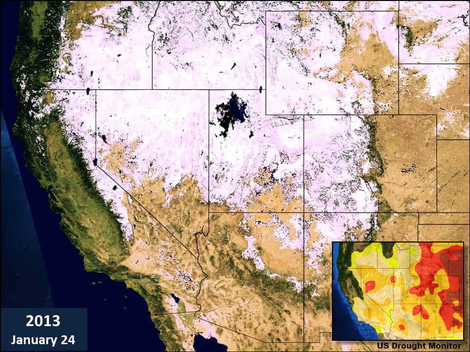
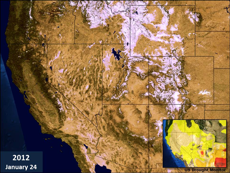
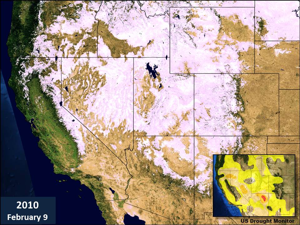
This true color product reveals how snow cover changes over time, and this is particularly interesting when snow cover is unusually low because of drought. During the 2013-2014 winter, California and Arizona have seen a remarkably reduced snowpack, creating concerns for water supplies that are fed by spring snowmelt and a hightened risk of early season wildfire. Note the reduced cover on the January 2014 map in California's Sierra Nevada and in the interior ranges of southern Utah and Colorado that comprise the headwaters of the Colorado River. Also compare how the greenness of California lower elevation forests and agricultural central valley varies with high elevation snowpack.
While this variation in snow cover has been extreme in recent years, monitoring snow cover provides only some insights into snow pack depth and nothing about the snow's water content. For detailed snowpack and water content insights, consult the US Weather Service's snow monitoring website: http://www.nohrsc.noaa.gov/nsa/.
References
NASA Earth Observatory website. February 2014. http://earthobservatory.nasa.gov/IOTD/view.php?id=83124&src=eoa-iotd