Development cuts forests near Raleigh
02/03/2012 - 14:18
More information about this event
Disturbance Type(s):
Development
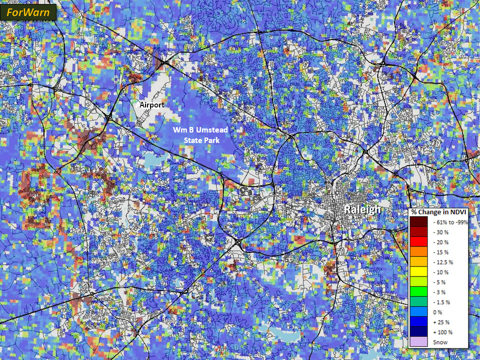
Substantial forest area has fallen to development in the periphery of many urban areas over the last decade. The image below shows deforestation in the periphery of Raleigh, NC as yellow to red anomalies. Blue areas have not changed during the last decade. This reveals that many forested inliers have been converted south and east of downtown, but that large areas have been converted west of the city along the outer highway belt. The large block of unroaded blue northwest of downtown is a state park.