Assessing defoliation in the Boise National Forest


More information about this event
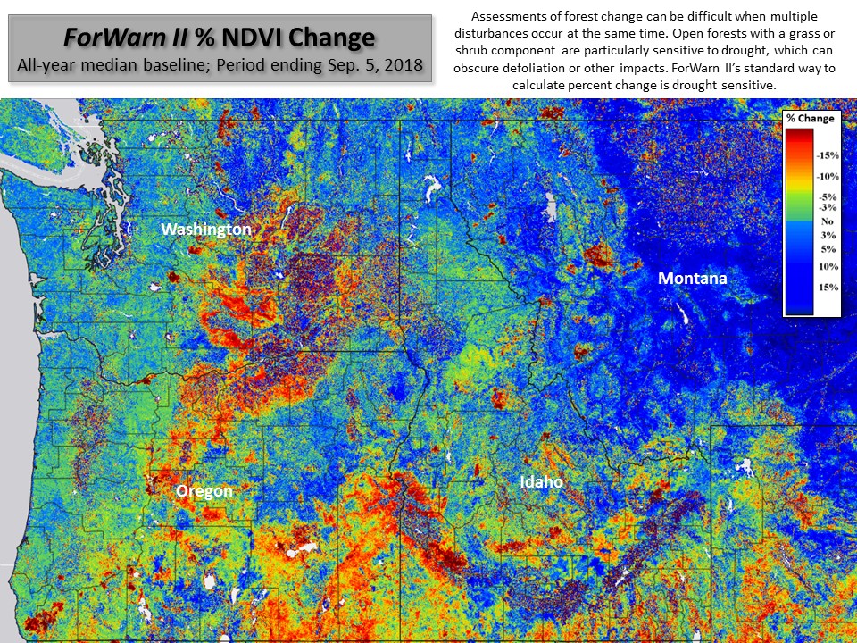
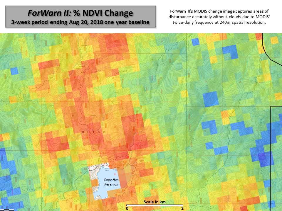
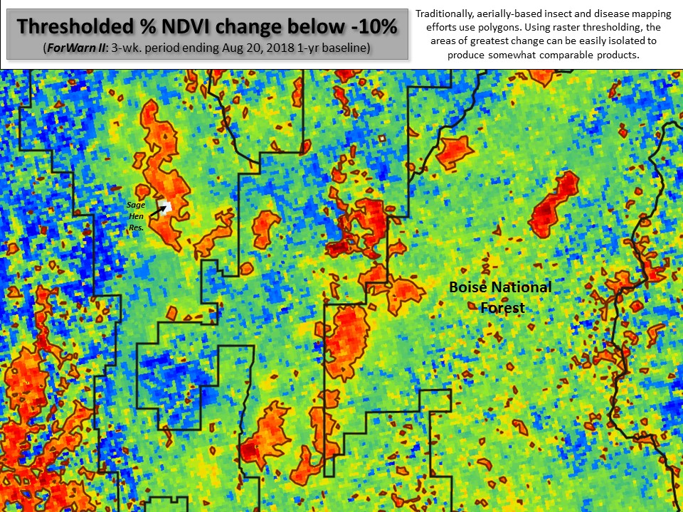
ForWarn’s ability to accurately map defoliation comes from the high temporal frequency of the source imagery (MODIS). With any change detection, multiple disturbances are often at work in the same landscape at the same time, so careful assessment requires consideration of other stressors or disturbances.
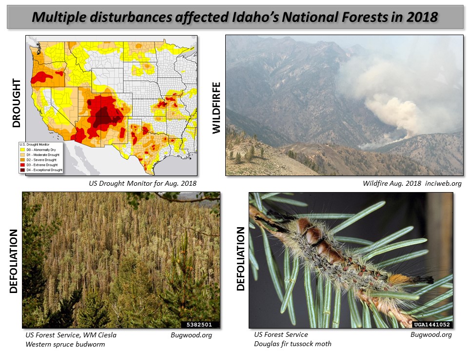
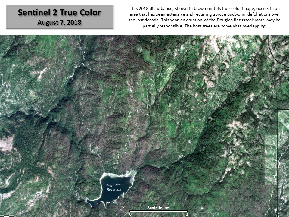
In the Boise National Forest, defoliation from the spruce budworm and large wildfire have been recurring every year. Recently, a periodic eruption of the Douglas fir tussock moth has begun, and drought is episodic.
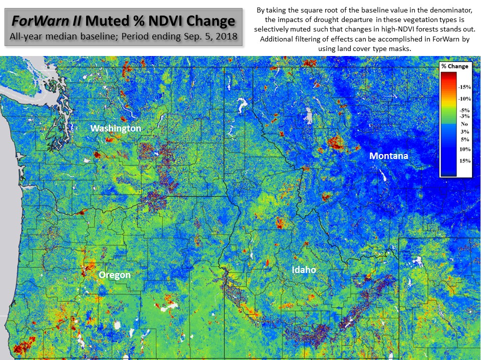
ForWarn II has a supplementary change algorithm that mutes the effects of drought. It calculates percent change by taking the square root of the denominator, which is the pre-disturbance baseline. This reduces the volatility that grass and shrubs exhibit given their drought sensitivity. Meanwhile, ForWarn II’s ancillary data help isolate wildfire and fuels treatments.
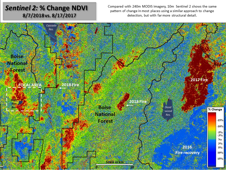
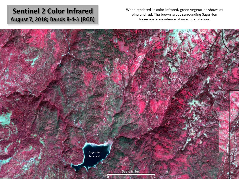
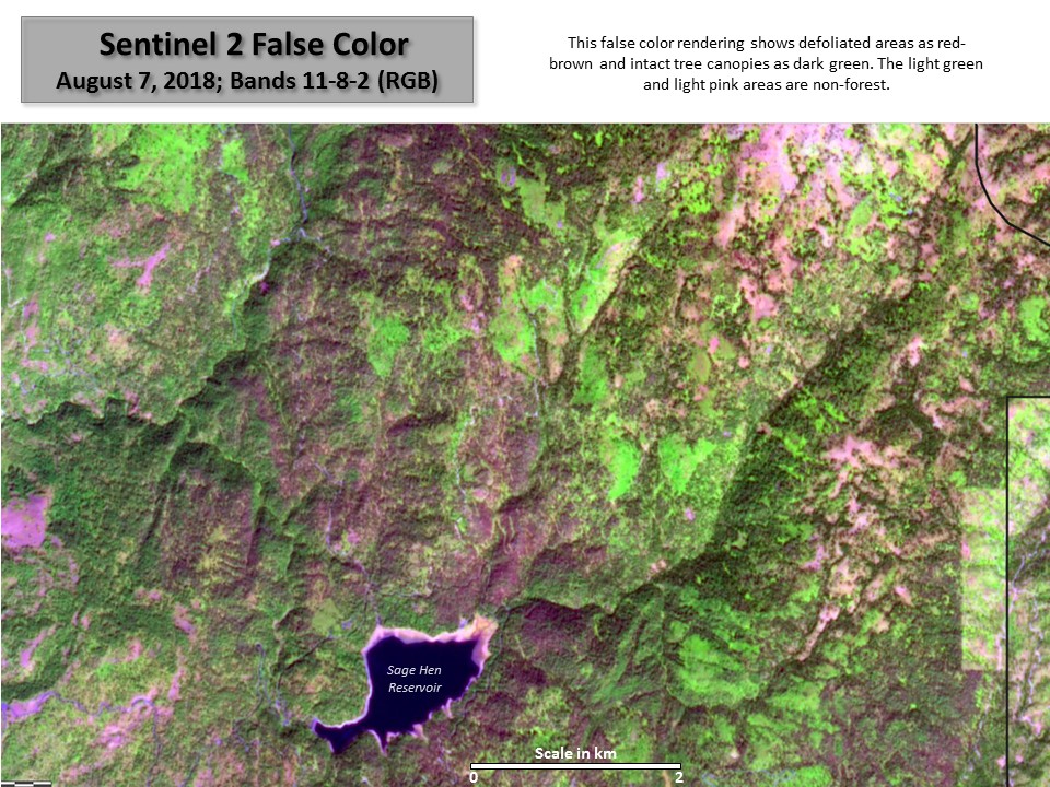
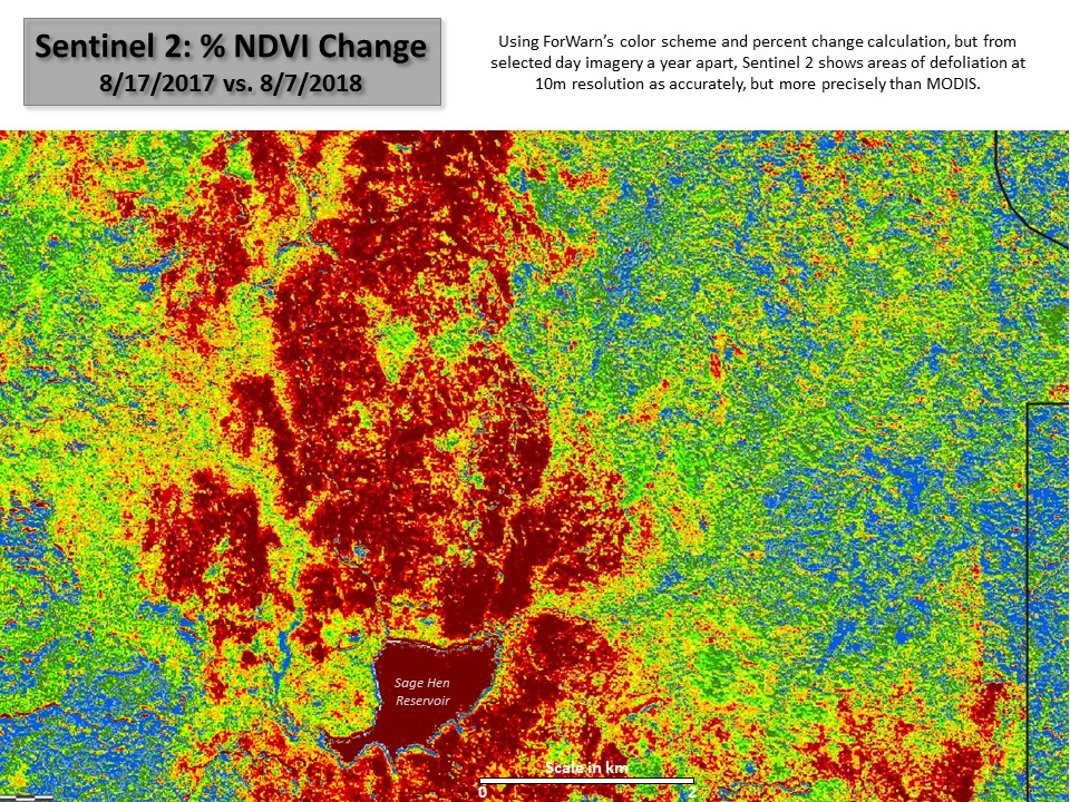
To further assist with assessment, ForWarn II now provides links to recent 10m Sentinel 2 imagery. While these high resolution images, like Landsat, must be processed separate from the ForWarn viewer, seeing recent high resolution imagery helps determine if disturbances are real and what may have caused them.
References
2017 North Idaho Douglas-fir Tussock Moth Monitoring Report