ForWarn II maps hail damage to Midwestern crops

More information about this event
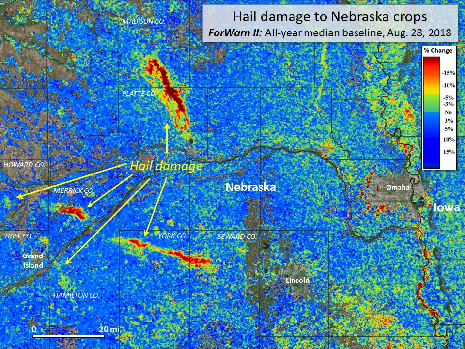
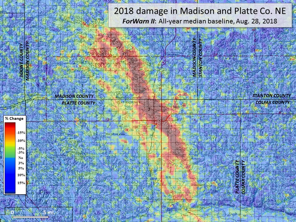
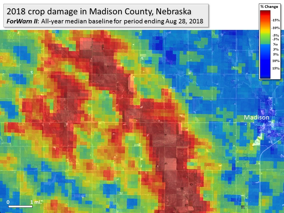
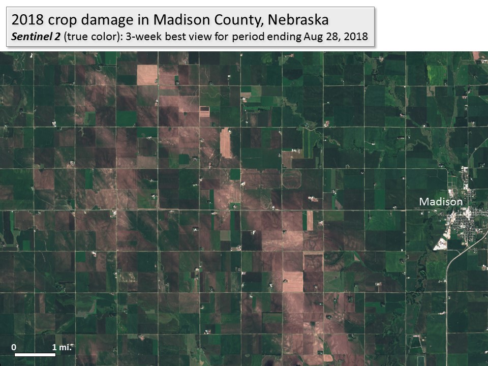
ForWarn's all-lands approach to monitoring provides valuable insights into crop damage caused by summer storms. In July and August of 2018, hail storms struck eastern Nebraska causing severe damage to corn and soy.
Remote sensing provides an invaluable way to track severe weather's effect on agricultural production, especially when it can be delivered soon after the event. Most storm reports of hail, for example, do not result in detectable change, suggesting that they are of limited scope or severity. Using ForWarn's Early Detect, these storm effects are recognizable immediately following the event, often within 8 days. Both the spatial pattern of the storms and insights from NOAA' Storm Prediction Center's scattered storm reports suggest that this particular damage was caused by at least two storm events--one occurred on July 27 and a second on Aug. 6, 2018. While reports are limited to where human observers happened to be and report, ForWarn's map shows the extent and severity of impact with a systematic, uniform process.
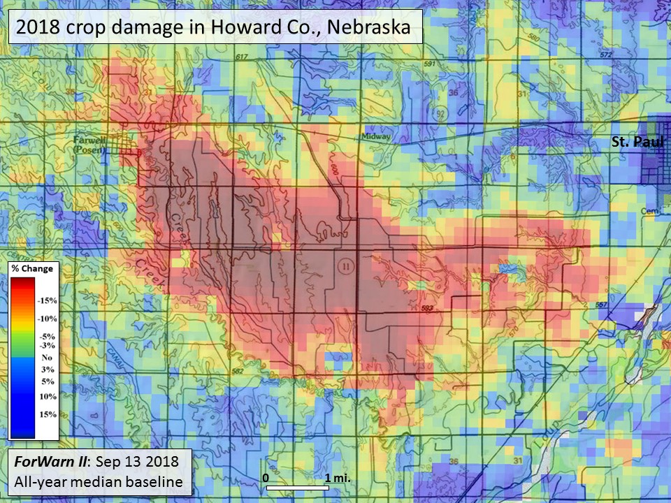
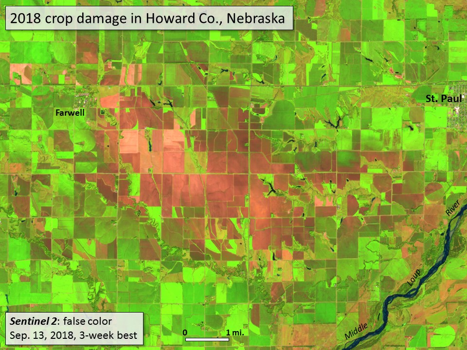
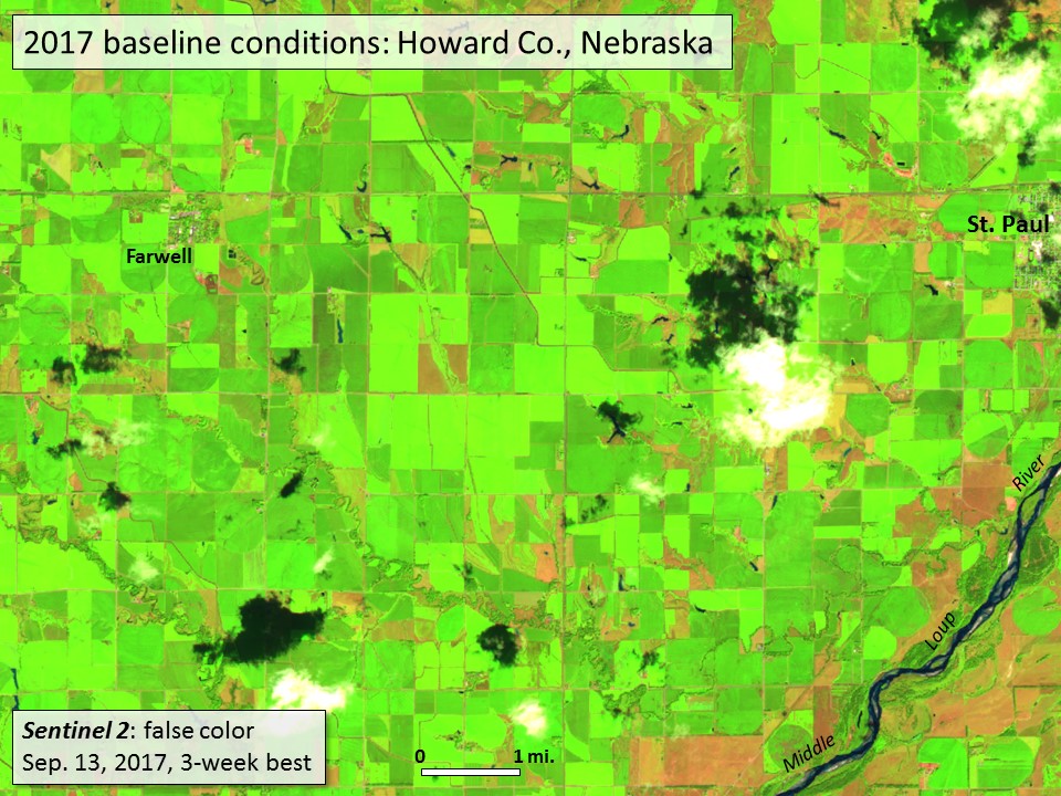
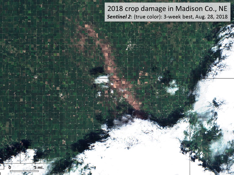
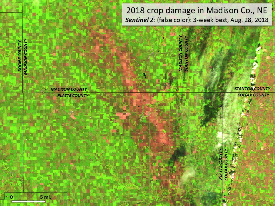
All visible change in these agricultural landscapes is not caused by disturbance. MODIS' 240m spatial resolution is also fine enough to detect crop rotations. ForWarn's approach to using the MODIS data stream excels at accurately mapping disturbances in cloud-prone areas, given its twice-daily frequency. Note on the paired 10m Sentinel 2 imagery the confounding problems of clouds and cloud shadows.