Hurricane Sandy strikes Northeastern forests
More information about this event
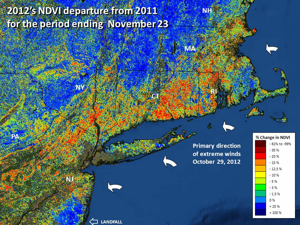
Hurricane Sandy, one of the most damaging hurricanes to strike the United States, tested the monitoring ability of the ForWarn system. Detecting any disturbance is difficult during the spring and fall because vegetation is actively changing due to normal seasonal dynamics. Normal variation in weather can advance or retard the progress of these transitions by a week or more making it hard to know if observed change is from an early fall or an event. Hurricane Sandy struck the North Atlantic at the end of October which was in the middle of seasonal leaf decline. The image shown conveys the forest change shortly after that. Note the coast-to-interior gradient in severity and the linear trending severe decline that conforms to ridgelines across New Jersey, upstate New York and eastern Pennsylvania. Also note that Long Island may have protected western Connecticut a bit, as Rhode Island and the eastern portions of Connecticut show more extreme change than do areas to the west. As this map only shows change to forests, damage to non-forest coastal vegetation and urban areas is not shown.
References
NOAA information on Hurricane Sandy. http://www.nhc.noaa.gov/data/tcr/AL182012_Sandy.pdf.