Arizona bears the Wallow
More information about this event
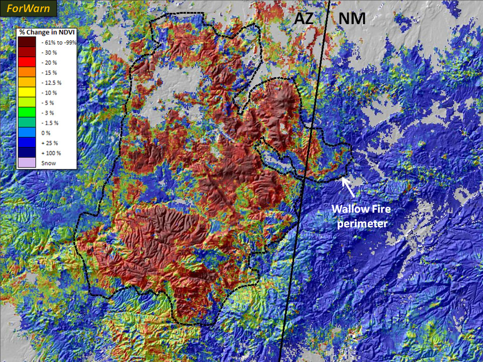
In June, the Wallow Fire burned over half a million acres in east-central Arizona, much of it on the Apache-Sitgreaves National Forests. A substantial portion of the burn area was of high severity, killing millions of trees outright. Looking south-southwest over the Escudilla Mountain Fire Lookout Tower (upper left), the effects of the high severity fire are clear. This observed severity is consistent with the ForWarn map from July (upper right, shown with 50 percent transparency) that provides an even broader landscape context at the northeastern corner of the burn. At a regional scale the severity of the entire fire is shown as of September 13, 2011 (below). Note that severity is highly variable within the fire and that there is some reduction in vegetation outside the burn area that is mostly from drought. (Photo credit: Arizona IMT)