Yazoo tornado recovery
02/03/2012 - 14:16
More information about this event
Disturbance Type(s):
Weather
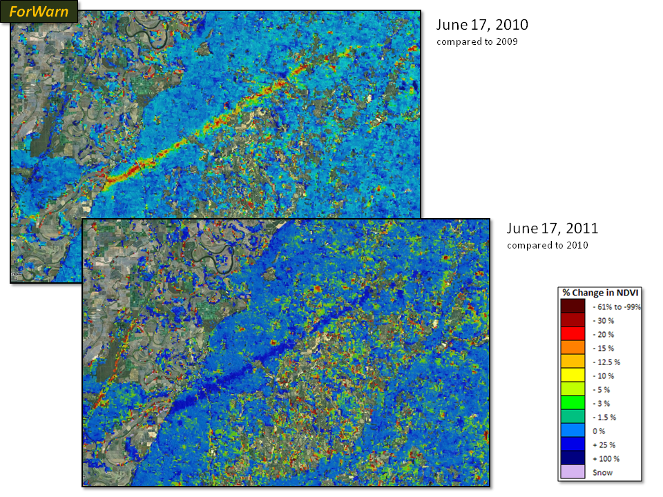
On April 24, 2010, a lethal F4 tornado struck the forests east of Yazoo City, Mississippi. Within a few weeks the path of the storm and patterns of severity are clearly shown with this comparison of conditions relative to the same time in 2010--the year before the event (top image). After one year of recovery, that same track is shown in dark blue compared to the post-disturbance 1-year baseline. Had the long-term baseline been used for 2011, the path would still be shown as anomalously low as just one year of recovery was not enough to regain the decadal norm. Such systematic monitoring allows disturbance and recovery to be tracked.