Tracking Gypsy Moth emergence and severity with magnitude and duration


More information about this event
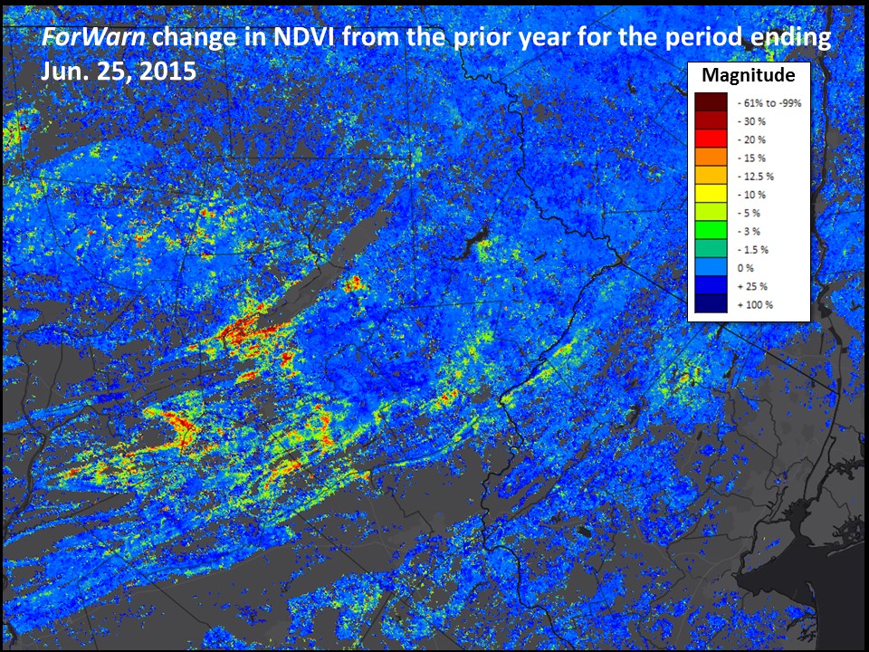
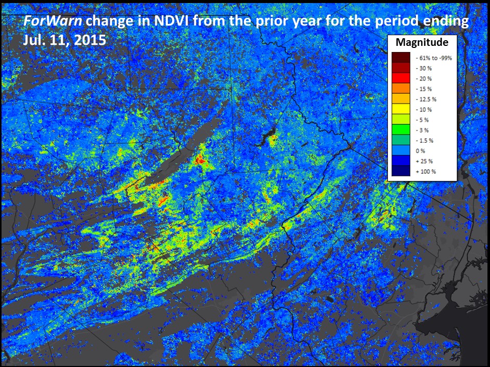
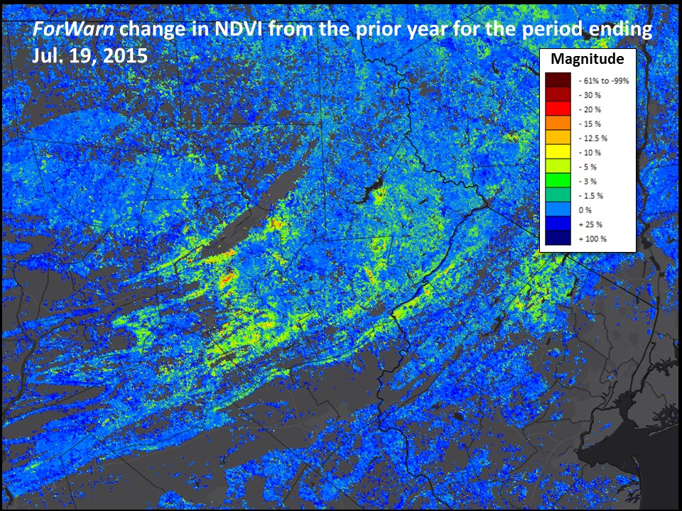
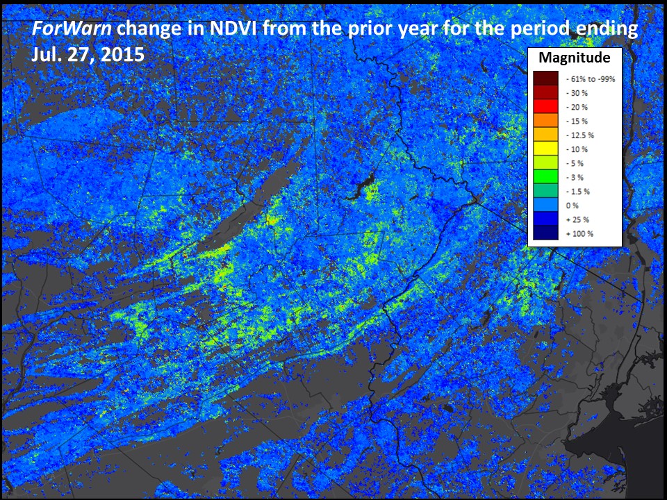
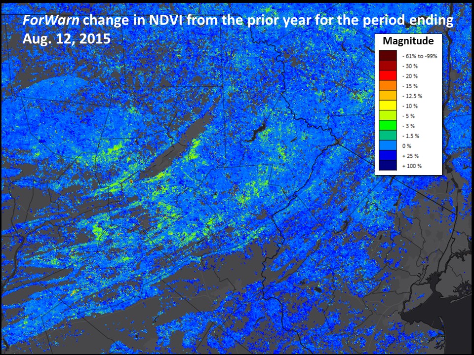
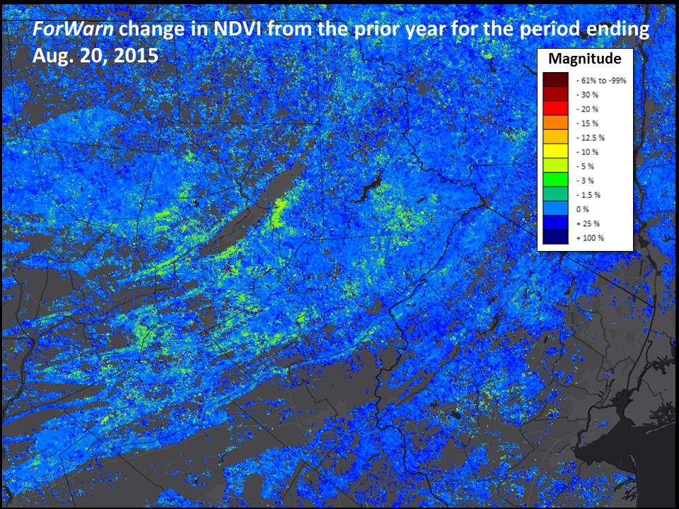
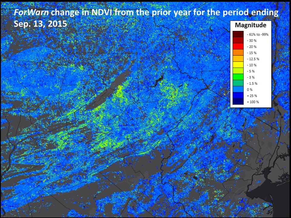
Remote sensing is adept at identifying and qualifying many forest disturbances, but there remains a substantial need to further quantify actual impacts in many cases. Traditionally, vegetation change-detection approaches, such as that used by ForWarn, identify and measure disturbance severity as the magnitude of change of some measure of reflected light between two dates or periods. ForWarn tracks the percent change in NDVI relative the prior year or years, with this index falling or rising as foliage cover shifts.
Daily MODIS satellite imagery is particularly useful for tracking disturbances that unfold gradually and for discriminating between ephemeral and persistent disturbance impacts. This knowledge can be useful for isolating cause of disturbance, and for predicting ecological effects across the landscape. For some critical measures, such as annual growth or productivity, the magnitude of departure for a given day or period may not be particularly telling. Moreover, clouds and atmospheric issues can provide a false sense of change that is only contextualized by a multi-period or seasonal perspective. The seasonal duration of disturbance impacts (as measured by the persistence of departure anomalies) can provide that context, and it constitutes a unique new measure for forest monitoring.
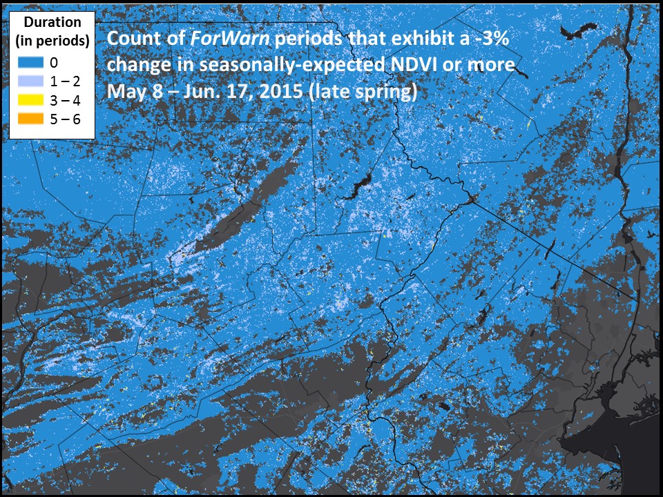
For a given period, disturbances in ForWarn of high magnitude can have a range of actual ecological impacts. In spring, severe departure is often caused by the ephemeral loss of foliage from leaf stripping or damage from wind or hail and the burning of herbaceous vegetation. High magnitude anomalies also include longer-lasting impacts such as clearcut logging and extensive tree mortality. Monitors gain important clues about impacts by tracking these disturbed places over a period of weeks and across seasons to see if they recover.
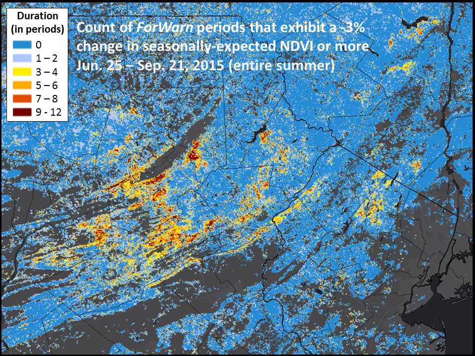
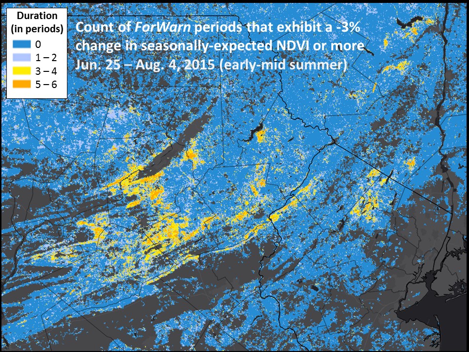
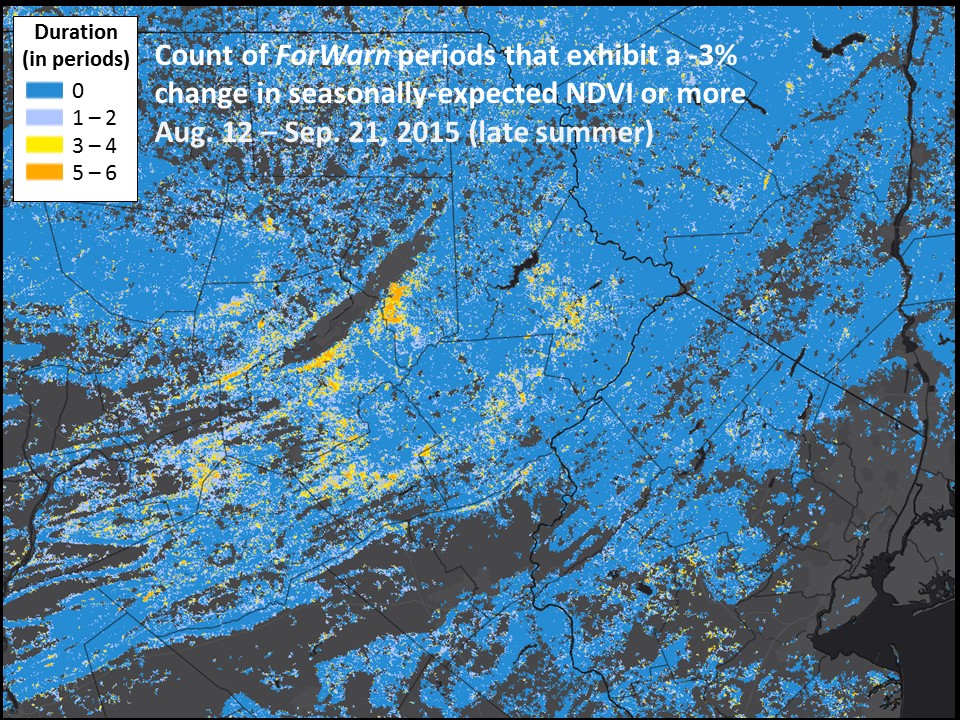
ForWarn's Seasonal Duration products help discriminate the ephemeral from persistent impacts by recording the count of 8-day monitoring periods that fell below a given threshold of magnitude (-3%) using the standard 1-year baseline. Six- and 12-week spring and summer disturbance duration maps are available from 2006 to the current year. These maps provide a simple way to identify areas that have experienced long lasting, but low intensity departure that are easily overlooked due to low magnitude disturbance or random background atmospheric variation.
The usefulness of Seasonal Duration products and the information they convey apart from Period Magnitude products is shown by the massive Gypsy Moth outbreak of 2015 in northeastern PA, northern NJ and NY. The areas of longest seasonal departure correspond well to areas mapped by aerial sketch mappers in 2015, yet ForWarn's Seasonal Duration product reveals unmapped areas of NDVI departure that may have also been from Gypsy Moth defoliation, yet damage from the Oak Leafroller and Fall Cankerworm were also mapped over sizable areas this year. While highly precise, and particularly useful for causal attribution, like aerial photography, aerial sketch mapping results can be limited by the number and location of flights conducted. When combined with high frequency satellite observations, the inherent strengths of both technologies can be exploited for improved forest disturbance mapping.
References
For more information on Gypsy Moth management in Pennsylvania, click here: http://www.dcnr.state.pa.us/forestry/insectsdisease/gypsymoth/
PA's Forest Health Highlight for 2015: http://www.fs.fed.us/foresthealth/fhm/fhh/fhh_15/PA_FHH_2015.pdf
de Beurs, KK and PA Townsend, 2008. Estimating the effect of gypsy moth defoliation using MODIS. Remote Sensing Environment, 112(10):3983-3990.
Spruce, JP, S Sader, RE Ryan, J Smoot, P Kuper, K Ross, D Pradow, J Russell, G Gasser, R McKellip, W Hargrove. 2011. Assessment of MODIS NDVI time series data products for detecting forest defoliation by gypsy moth outbreaks. Remote Sensing of Environment. 115: 427-437. http://www.treesearch.fs.fed.us/pubs/37274