Massive hailstorm destroys Midwestern crops
More information about this event
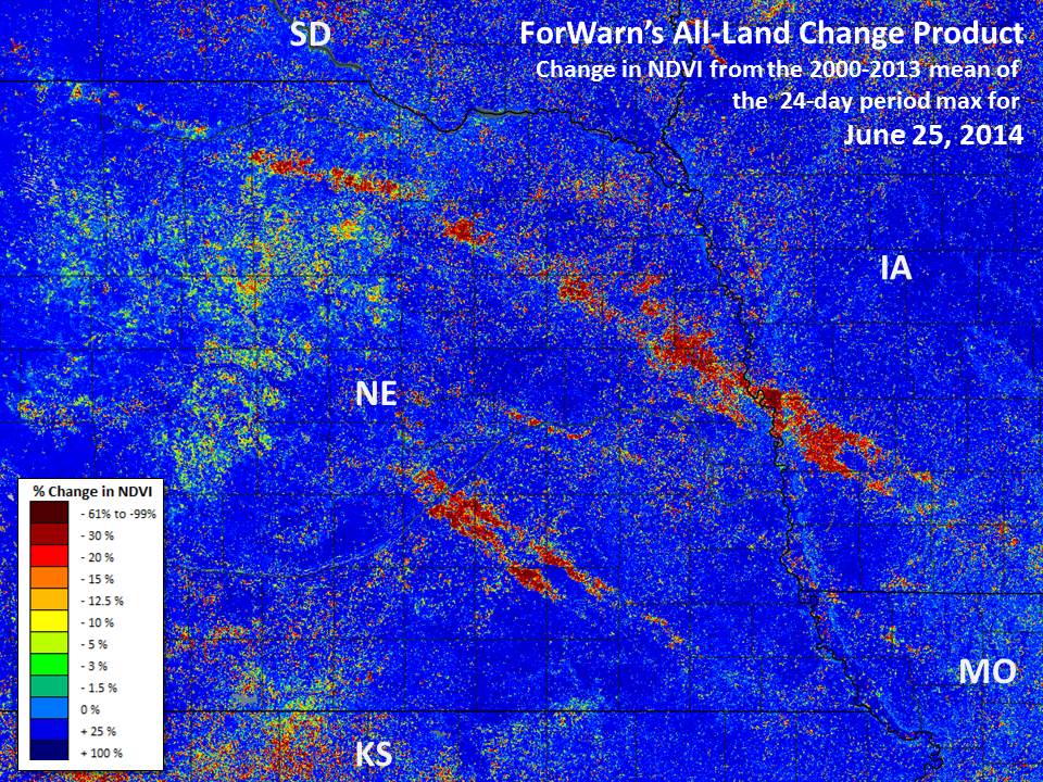
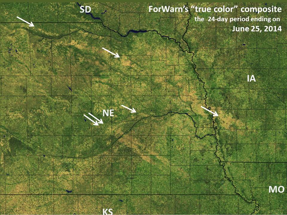
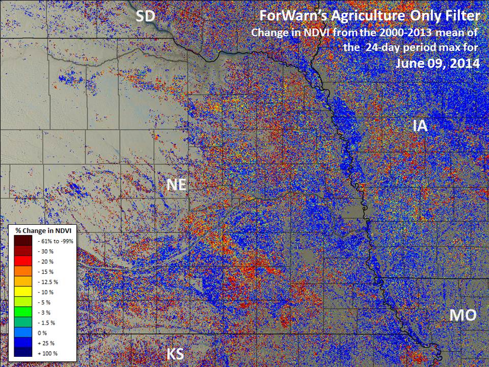
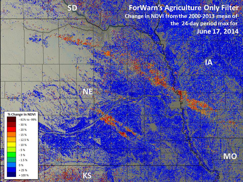
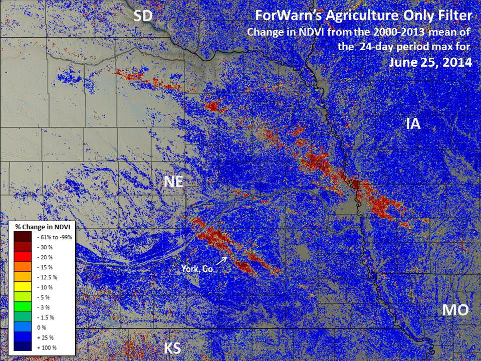
During the first week of June 2014, hail caused significant damage to corn and soybean fields in eastern Nebraska and western Iowa. By June 9th, ForWarn's all-lands product was beginning to show the losses that these storms inflicted across multiple counties despite later than average crop growth in May, and when ForWarn's next product was produced for June 17th, the losses from hail were clearly visible. These maps were made by comparing current NDVI conditions to the all-year mean value for a 24-day period maximum covering the years 2000-2013.
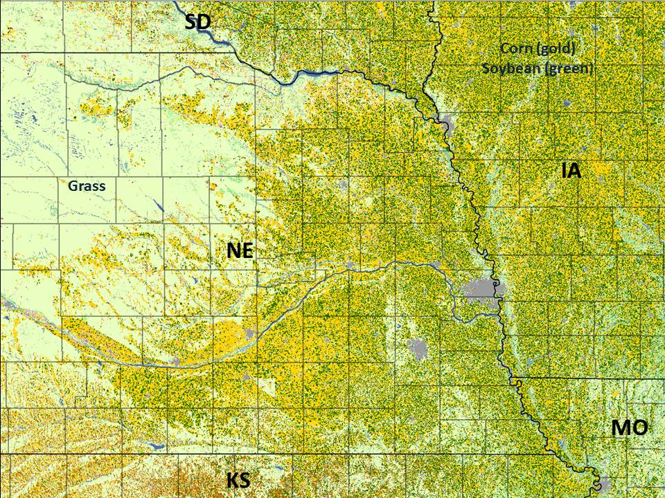
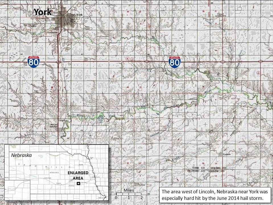
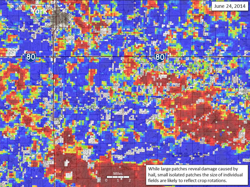
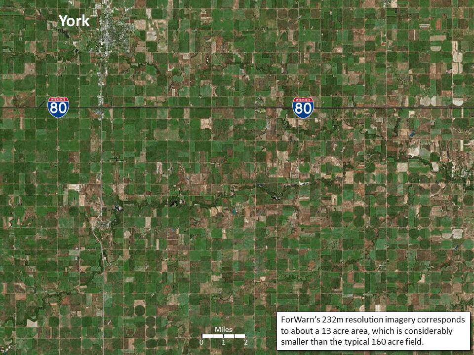
Taking a closer look at York County, Nebraska near the heart of this devastation, we can see the northwest to southeast banded structure of this storm system where hard-hit areas were four miles wide, with less affected areas between. As corn and soybean are sometimes rotated, fine scale pattern corresponding to individual fields often relates to this change in crop as corn and soybean exhibit differences in NDVI through the growing season.