Early Detect captures hailstorm in near real time
More information about this event
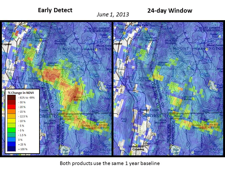
ForWarn's standard calculation of the current state of vegetation is based on the maximum NDVI value observed for each 24 day period. This standardized window is needed to minimize the chance that clouds or other atmospheric effects will cause misleading results in the change product. For many periods and in some portions of the US, a much shorter window is sometimes possible. ForWarn's new Early Detect product uses the most recent clear view to capture change as soon as possible, even though clouds can sometimes cause issues. Its utility was nicely demonstrated after this late May 2013 storm that hit Massachusetts, New York and Connecticut. Personnel from a nearby USDA Forest Service State and Private Forestry Office confirmed that this was hail damage in the field. Based on NOAA storm reports, this damage probably occurred on May 29 just a few days before ForWarn's early detection, although an earlier wind-hail event from May 22-23 is another possibility. This animation compares the progression of periods in the Early Detect product (left) with that of the standard 24 day product (right). Note that Early Detect showed the severity and extent of this storm event at least a week earlier than the standard ForWarn product.